San Felipe de los Alzati
Discover
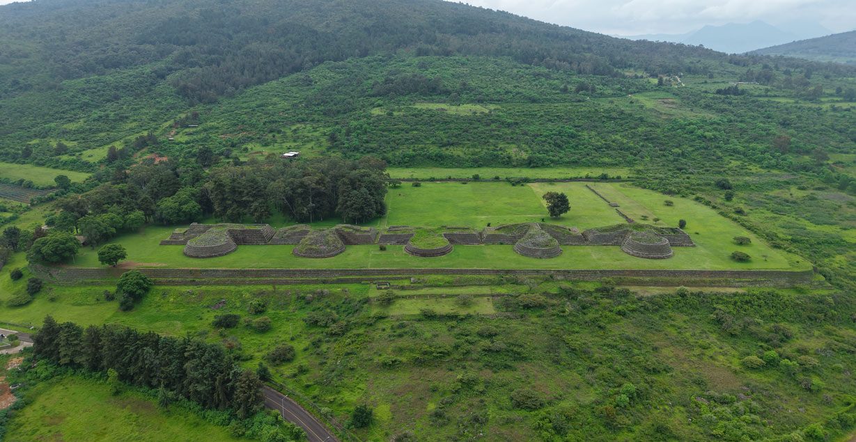
Historical sources, such as the Jesuit Francisco Javier Clavijero’s Historia antigua de México, mention that the region was inhabited by this group, a statement that archaeology has confirmed. Unlike Tarascan areas such as Tzintzuntzan and Ihuatzio, this settlement lacks the architectural characteristics typical of those areas, such as mixed-plan structures. Instead, pyramids built with superimposed bodies and central stairways leading to plazas located at different levels predominate here.
During its heyday, this archaeological site covered some 52 hectares, extending beyond the area currently open to the public, making it the most important complex in eastern Michoacan. It is also the only site in this region managed by the National Institute of Anthropology and History (INAH) that is open to visitors. Its geographic location played a crucial role in pre-Columbian Mesoamerica, being a strategic point in the region.
For more information about this archaeological site, click here.
The place has two names because it is located on the lands of two communities. One is Zirahuato, which in Purépecha means “cold hill”, and the other is San Felipe Calvario. However, at the end of the 19th century, the surnames of local heroes were added to these names. Thus, Zirahuato was renamed Zirahuato de los Bernal, in honor of Félix and Arturo Bernal, and San Felipe Calvario was renamed San Felipe de los Alzati, in recognition of José María, Marcos and Darío Alzati, who fought bravely for the Republican cause during the Second Mexican Empire. The Alzati family, originally from the district of Zitácuaro, stood out in the struggle alongside General Vicente Riva Palacio, José María Alzati being a trusted man of the general.
The site suggests the existence of a ball game, palaces and residential areas, among other buildings, yet to be explored. In 1963, Román Piña Chan carried out the first archaeological intervention at the site following a report of looting on the north side. In 1973, formal investigations began under the direction of archaeologists Otto Schöndube Baumbach, Ramón Carrasco and Estela Peña Delgado. Thanks to these explorations and ethnohistoric studies, four architectural complexes were identified, two of which are currently on display: the Great Pyramid and the living area.
Did you know that…?
In 1963, the first archaeological intervention was carried out at the site, when archaeologist Román Piña Chan responded to a report of looting on the upper part of the north face.
The ceremonial center is located at the foot of the Zirahuato volcano, whose altitude ranges between 1,930 and 2,100 meters above sea level.
The structures were integrated into the natural terrain by means of retaining walls, using volcanic stone.
Flat stones were used on the facades, while the stairways and corners were reinforced with worked rocks.
Throughout the archaeological zone petroglyphs can be observed, being the spiral one of the most frequent motifs, visible even on the faces of the main pyramid. This symbol is associated with the observation of solar movement. In addition, a hieroglyph representing Tezcatlipoca, a fundamental deity in the Mexica cosmovision, has been identified, underlining the symbolic connection between this site and Mesoamerican beliefs.
Did you know that…?
Archaeological explorations began in 1973 under the direction of archaeologists Otto Schöndube Baumbach, Ramón Carrasco and Estela Peña Delgado.
